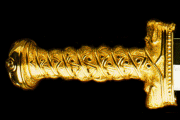
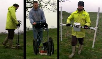
The three types of geophysics equipment used to scan The Berth: a resistivity meter, ground- penetrating radar and a proton magnetometer.
The Archaeology
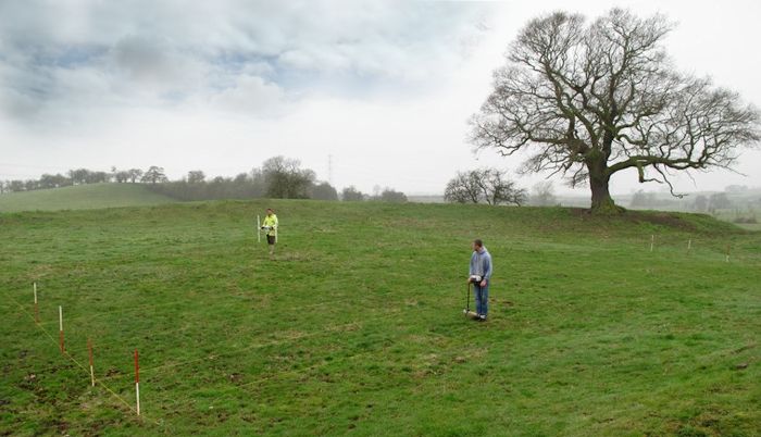
The geophysics survey of The Enclosure at The Berth. Berth Hill can be seen in the background.
The Song of Llywarch the Old implies that, as founding ruler of the kingdom of Powys, Owain was buried in a special location at the Churches of Bassa: somewhere referred to as “Trafael’s Acre”. There was only one spot at The Berth matching the description: the oval field, approximately an acre in size, now called The Enclosure. Graham therefore knew where to look. He also knew what to look for. Owain Ddantgwyn had been an historical figure who lived during the early sixth century, and archaeology has revealed that during this period the dead were usually interred in a circular pit, and high-status warriors were often buried with weapons, such as an axe, sword or shield. Only a professional archaeological survey could reveal if there was indeed such a grave in The Enclosure at The Berth.
The Berth is on private land and, because it is also listed as a protected site, an excavation was initially out of the question. However, these days, modern technology has made it possible to see what lies buried beneath the ground without the need to dig. It’s called geophysics, where various types of equipment, such as ground- penetrating radar, can produce computer-generated images of what hides in the soil. Graham organized a geophysics survey of the area, overseen by archaeologist Dr. Roger White of Birmingham University, which revealed disturbances in the ground, right in the middle of The Enclosure. At some point in the past, a single circular pit had been dug here to a depth of around six feet. The archaeologists were certain this had not been a house or any other similar structure, and was likely to have been a burial. It was indeed precisely what would be expected of a royal burial from the early Dark Ages. Furthermore, at the centre of the ditch there was a diamond-shaped piece of metal about six inches wide, possibly the central boss of an ancient shield. As it was a single, isolated burial the archaeologists concluded that it was probably the grave of someone important. Although the technical restraints of the equipment made it impossible to reveal the presence of aged and fragile bones at that depth, the scan had produced compelling evidence that there was indeed a grave right where the ancient poem indicated Owain Ddantgwyn - the very figure Graham had identified as the historical King Arthur - was laid to rest.
Intriguingly, The Berth Enclosure was an island during the Dark Ages. Could it have been the fabled isle of Avalon where, according to legend, Arthur was taken after he was mortally wounded during his final battle? Graham firmly belives that he has identified the true site of Avalon and the last resting place of the historical King Arthur.
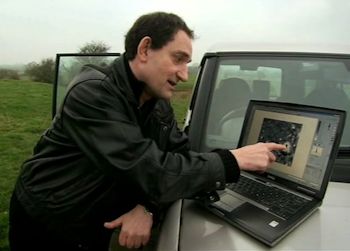
Graham examines the results of the geophysics survey showing the anomaly at centre of The Enclosure - probably an ancient burial ditch
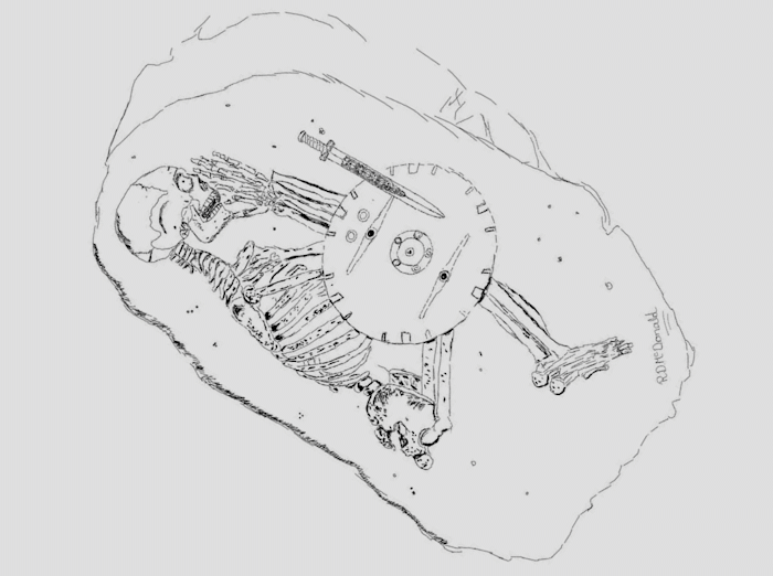
Drawing by archaeologist Ruth McDonald of Liverpool University showing the human remains that might lie buried at the centre of The Enclosure at Baschurch.
Film about Graham’s the search for the historical King Arthur’s and the geophysics survey of The Berth.